Traillink by Rails-To-Trails Conservancy
Chester Valley Trail
State(s): Pennsylvania
Counties: Chester, Montgomery
Length: 14 miles
Trail end points: King of Prussia Rd. just east of I-76 (King of Prussia) to N. Ship Road (Exton)
Trail surfaces: Asphalt
Trail category: Rail-Trail
Cross County Trail (PA)
State: Pennsylvania
Length: 3 miles
Surface: Asphalt
Cynwyd Heritage Trail
State: Pennsylvania
Length: 2 miles
Surface: Asphalt, Crushed Stone
Manayunk Bridge Trail
State: Pennsylvania
Length: 0.4 miles
Surface: Concrete
Peace Valley Park Hike & Bike Trail
State: Pennsylvania
Counties: Bucks
Length: 4.1 miles
Trail end points: N. Champman Road to Creek Road
Trail surfaces: Asphalt
Trail category: Greenway/Non-RT
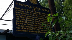
Pennypack Trail
State: Pennsylvania
Counties: Montgomery, Philadelphia
Length: 14.4 miles
Trail end points: Byberry Road (Huntingdon Valley) to State Road (Holmesburg)
Trail surfaces: Asphalt, Dirt
Trail category: Rail-Trail
Perkiomen Trail
State: Pennsylvania
Counties: Montgomery
Length: 19.5 miles
Trail end points: Hill Rd. at Lumber St. (Green Lane) to Station Avenue (Oaks)
Trail surfaces: Asphalt, Crushed Stone
Trail category: Rail-Trail
Powerline Trail (PA)
State: Pennsylvania
Counties: Montgomery
Length: 4.8 miles
Trail end points: Blair Mill Road to Horsham Road (Township Municipal Complex)
Trail surfaces: Asphalt
Trail category: Greenway/Non-RT
Project: Rail Park
State: Pennsylvania
Length: 3 miles
Surface: Gravel
Schuylkill River Trail – Schuylkill Banks Boardwalk
State: Pennsylvania
Length: 0.4 miles
Surface: Concrete
Schuylkill River Trail – Phoenixville to Pottstown
State: Pennsylvania
Length: 9.6 miles
Surface: Asphalt, Crushed Stone
Schuylkill River Trail – Thun Trail
State: Pennsylvania
Length: 18.3 miles
Surface: Asphalt, Crushed Stone
Schuylkill River Trail – Valley Forge to Philadelphia
State: Pennsylvania
Length: 27 miles
Surface: Asphalt
Skippack Trail
State: Pennsylvania
Length: 3.3 miles
Surface: Asphalt
Tacony Creek Trail
State: Pennsylvania
Length: 1.8 miles
Surface: Asphalt
Wissahickon Valley Park (Forbidden Drive)
State: Pennsylvania
Length: 7 miles
Surface: Asphalt, Gravel
202 Parkway Trail
State: Pennsylvania
Length: 8.4 miles
Surface: Asphalt
 Well, I’m not a great photographer. These are all the park and trail photos from my phone, good and bad.